The Bavi Swell: Twenty Feet at Cloud 9 in July
A super typhoon that never came near us sent the biggest out-of-season waves anyone here can remember. What happened, and what it says about reading a forecast.
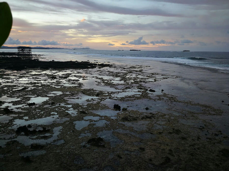

We write a lot on this site about how quiet July is. The habagat is only just settling in, the reefs need a push from the Pacific to do anything, and most visitors in early July are here for lagoons rather than barrels. Then a storm that never came within a thousand kilometres of Siargao proved that a calendar is only ever a rule of thumb.
What Bavi was
Super Typhoon Bavi, known as Inday inside the Philippine area of responsibility, intensified explosively in the first days of July while it was still far out over the western Pacific. At its peak it was the strongest storm on the planet: a central pressure around 901 hPa and gusts near 290 km/h. It went through the Northern Mariana Islands as a catastrophic Category 5 system before curving north and away from the Philippines.
That last part matters. Bavi never threatened Siargao directly. There was no landfall here, no storm surge, no evacuation. But a wind field roughly 1,600 kilometres across, sitting over open ocean for days, pushes an enormous volume of water ahead of it. That water arrived on our reef as swell.
What arrived
The forecasters saw it coming. By 3 July the swell models were showing 8 feet and more for Siargao with light west-southwest winds, which is offshore here, and far bigger numbers for Catanduanes and the Batanes further north. The central and eastern coasts of the country were squarely in the window.
The reality on the morning of 8 July was bigger than the numbers. Cloud 9 was producing faces that the people filming from the tower were calling twenty feet, the kind of size that here normally belongs to a big day in late October rather than midsummer. Video of that morning has since gone around the world, and the framing has been the same everywhere: a heavy winter pulse in the dead of summer, days after the World Surf League named this reef a Championship Tour stop.
Locally it looked like this. The main peak stopped being a peak; sets broke on the outside reef and rolled through as whitewater across the whole flat. Tuason was unrideable. The beach breaks to the south of town, which are usually where we send beginners in a lull, had rips strong enough that we kept the school closed. The lagoon side of the island, sheltered from the east, was flat.
Very few people surfed it, and every one of them was a local or a long-term resident who knows the reef at that size. There is no shame in that. Sitting on the tower with a coffee while the reef does something it does twice a decade is a completely legitimate way to spend a morning.
Why it matters if you are planning a trip
The calendar is a guide, not a promise. Our month-by-month post still stands: July is normally small, September and October are normally the most consistent, and you should plan accordingly. But the Pacific does not read blogs. A typhoon in the right place at the wrong time of year can deliver a week of serious swell in a month we describe as gentle, and the reverse is also true in season.
Learn to read a storm track, not just a swell chart. The size of a swell depends on how strong the wind is, how long it blows, and how much ocean it blows across. A storm that sits over open water for days, as Bavi did, sends long-period swell that keeps its energy over enormous distances. A storm that crosses land quickly sends much less. The best single habit for a surf traveller is to look at the synoptic chart alongside the wave forecast.
Big is not the same as good. Twenty feet at Cloud 9 was a spectacle. It was not surfable for almost anyone reading this, and it was not even the best day of the week for most people. Two days later, as the swell dropped to a solid head-high-plus with the same offshore wind, the reef was as good as it gets. That is the day to plan around.
Ask before you paddle. During a swell like this the reef looks different from the beach than it does from the water, and the channel that is safe at six feet is not safe at fifteen. If you are unsure, come to the shop first. We will tell you honestly whether today is your day.
What it did to the reef
Nothing that we can see. Cloud 9 breaks over hard coral and the swell came without a storm attached, so there was no debris and no surge. The boardwalk and the rebuilt tower took it without complaint, which is the first real test they have had since going back up. A useful thing to know ahead of the biggest event this island has ever hosted.
Come by any time. If the ocean does something like this again, we will be the ones on the deck with the binoculars, and we are happy to share the view.
← Surf NewsLatest from the crew
The Field Is Set: Who Surfs Cloud 9 in November
Trestles closed the regular season. The top 22 men and top 14 women, plus wildcards, go through Portugal to Siargao. And no, there is no QS at Cloud 9 in October.
Two Cloud 9 Surfers, One Asian Games Bronze
Surfing's first Asian Games ended with Jayuard Alciso beating Toby Espejon in an all-Filipino bronze-medal match in Japan: the Philippines' first surfing medal at the Games.
Love, Siargao Comes to Free TV
Alden Richards and Nadine Lustre's island romance is now on GMA Prime weeknights. What the show is about, and what to expect if it makes you want to come.